
About Mt. Ulap:
Mt. Ulap is one of the highest peaks in the Cordillera region, with amazing flora and fauna. Because of its temperature, the trees, grass, and flowers look so healthy, making the mountain look gorgeous. Our itinerary was, instead of a public vehicle, we chartered a van for our transportation to the North. Thirteen of us met at Crossing, including Rio, our Chinese visitor. From Manila to Baguio City took us six hours of travel, so instead of getting bored while on the road and the rains were dropping, it was filled with stories of our previous hikes.
Important Details about Mt. Ulap:
- Location: Brgy. Ampucao, Itogon
- Coordinates: 16.2904 N, 120.6312 E
- Height and Elevation: 1,846 MASL
- Hiking Difficulty: 3/9
- Trails Class: 1-3

How We Got to Mt. Ulap:
- From Manila, we rode in a Victory Liner bus to Baguio City.
- In Baguio City, we chartered a jeepney to Brgy. Ampucao.
We arrived in Baguio City past eleven in the morning. We had our breakfast/lunch at Emil Rose Restaurant. The ambiance inside this restaurant is amazing; there is no air conditioner, but the temperature is cool, and the foods taste good and are served elegantly. After the sumptuous lunch, we continued traveling to Itogon, Benguet.
From Baguio to Itogon is more than an hour of travel, but it was a bit challenging because of the bad weather. The rain and the wind were strong, and the roads were covered with fog, making zero visibility. It was past one in the afternoon when we arrived at the covered basketball court. Took a short break and processed the registration and guides.
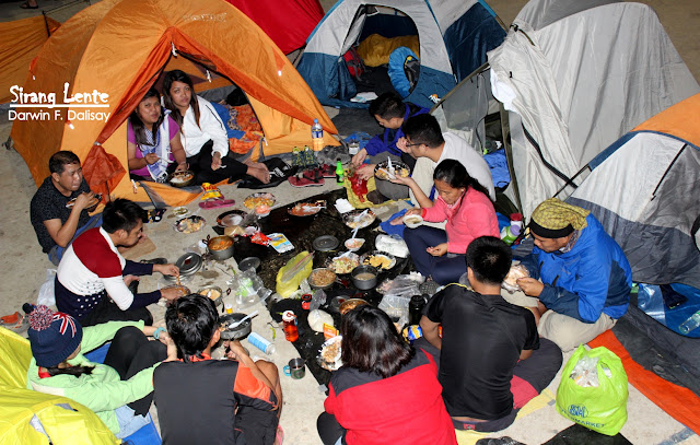
Mt. Ulap Weather Conditions:
The management did not authorize us to continue a day hike on Mt. Ulap because of the bad weather conditions. Instead, we set up a camp at the covered court, other groups followed, and we started preparing our dinner. After dinner, we had our socials and rested at around two in the morning. Three-quarters of the basketball court is covered, but the temperature is really cold.
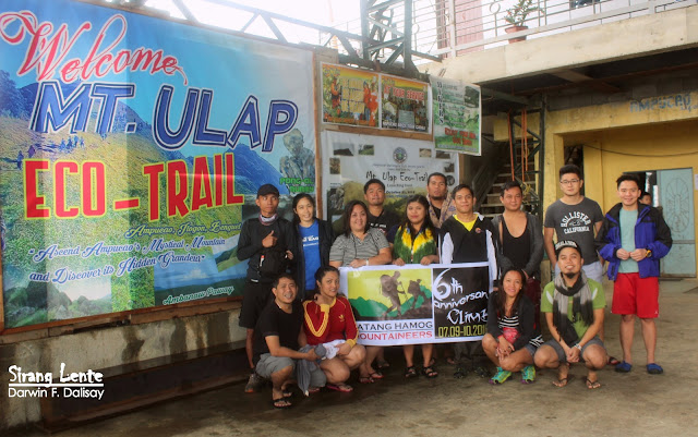
 |
| Photo: Batang Hamog Mountaineers and guests. |
The Start of Our Hike:

Important Reminder Before Hiking Mt. Ulap:
- The Trails of Mt. Ulap


 |
| Photo captured at the First Camp of Mt. Ulap. |
The Campsite of Mt. Ulap:
 |
| The view at the summit of Mt. Ulap. |
Reaching the Summit of Mt. Ulap:
It took us almost two hours from Camp 1 to Gongal or Camp 2. Upon arrival, hikers were having their photo ops on top of the boulders. The same scenario: the area is covered with thick fog, the wind is strong, and the raindrops are like blades slashing our skin because of its cold temperature. We stayed there for an hour and then, descent. We thought the weather would be fine, yet everything was the same. We were wearing raincoats, waterproof jackets, and umbrellas; those look good in photos, though.


The End of Our Hike:
This was Batang Hamog Mountaineers' 6th year anniversary! I am happy to see these people again. Sabi ko nga: "Kahit hindi matuloy ang akyat sa Mount Ugo, basta kasama ko ang mga indibidwal na ito, masaya na ako at hinding-hindi ko pag-sisisihan. Hangang sa susunod!"
Click Helpful Links Below:
- Read: List of Mountains
- Read: Hiking Mt. Apo
- Read: Hiking Mt. Mantalingajan
- Read: Hiking Mt. Guiting-Guiting
- Read: Hiking Mt. Hamiguitan
CLICK HERE TO HOMEPAGE: LIST OF ALL PROVINCES