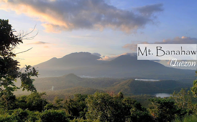
It is an active complex volcano located in Quezon Province. Dubbed as the "Holy Mountain," this giant bears a trail with a very calm ambience. To plant more trees, that's the main purpose of our hike. We chose this mountain because we want to preserve its hidden and majestic beauty. Though it is hard to trek due to its terrain, which is a rainforest, it is one of the most hiked mountains because it has healthy biodiversity, both plants and animals. Nonetheless, reaching the summit and heading back to the jump-off can give you a lifetime and unforgettable experience.
Specifications:
- Location: Quezon Province
- LLA: 14°04′03″N 121°29′33″E / 14.06750°N 121.49250°E
- Height and Elevation: 2,170 MASL
- Hiking Difficulty: 5/10, Moderate to Hard,

The Trails of Mt. Banahaw:
- This mountain is considered a rainforest, so the terrain is always wet, creating a wealthy ecosystem that preserves the wildlife. However, the terrains also serve as a planting ground for the farmers while the forest is one of their primary sources of fruits and even hardwood (not allowed).
- To transport their goods, they used horses, carabaos and cows, which made the trails muddy and slippery.
 |
| A photo on the Summit of Mt. Banahaw. |
The Summit of Mt. Banahaw:
- We reached the summit with no clearing; the area is surrounded by a thick fog while the cold wind blows.
- We stayed on the summit for an hour, hoping for a clear view. However, nothing had changed. Still, no clearing.
Side Trip to Kinabuhayan River: After a tiring hike, the perfect side trip should be a cool and relaxing body of water. Kinabuhayan River, this river is said to be holy, so there are groups who are worshiping inside the caves, Sta. Lucia falls and other parts. For me, it's a perfect place to relieve everything and enjoy nature's goodness.
This mountain is still CLOSE to HIKING.
